|
Hand in Order - Part A
1. Title Page 2. Location Worksheet 3. Place Worksheet 4. Interaction worksheet Hand In Order - Part B 1. Infographic created on easel.ly or paper submission |
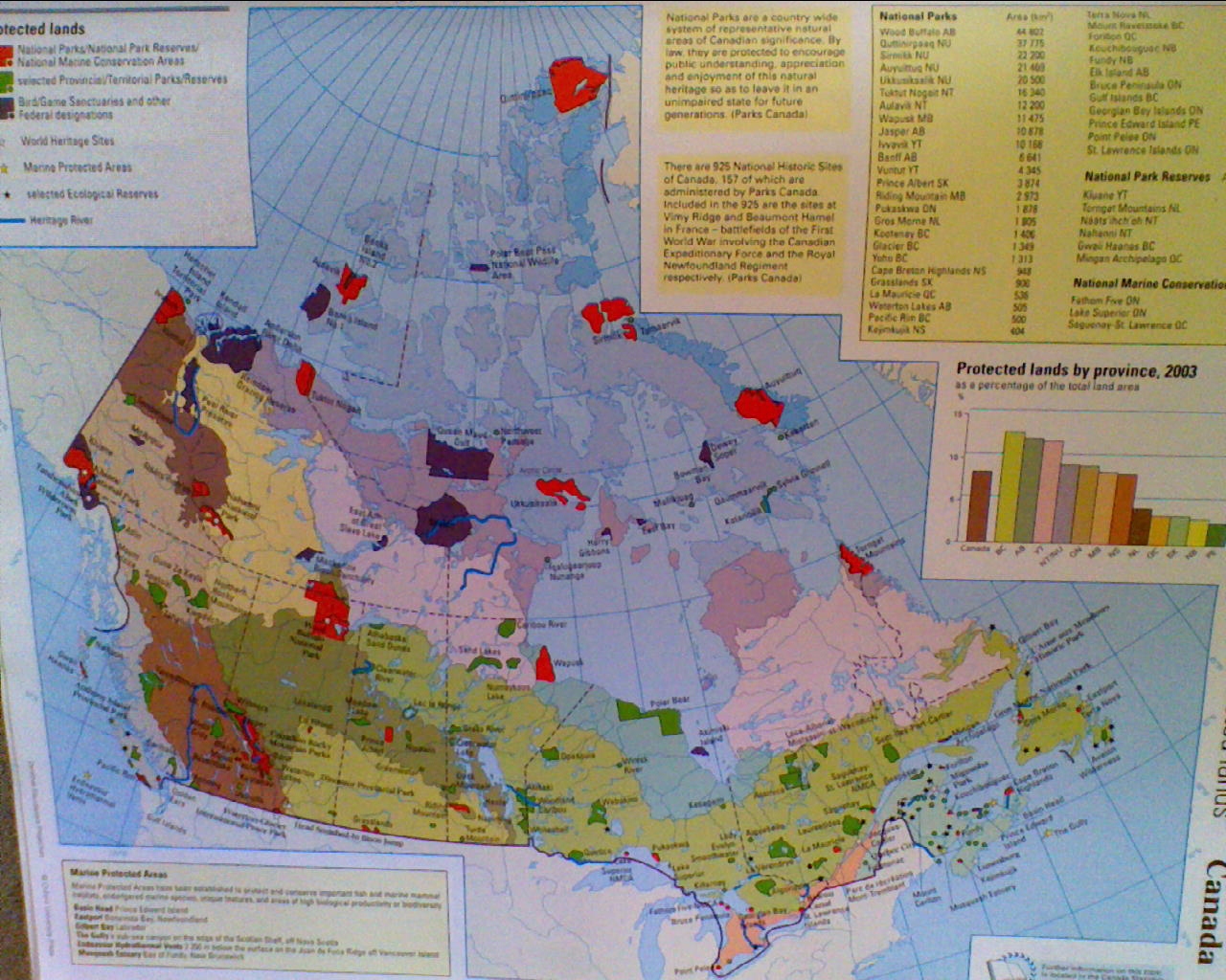
ResourcesPart 1 Wikipedia National Parks Website Parks Canada Website National Park Map and Ecozone Map from Classroom Atlas Ecozones of Canada Map Part 2 Create your own logo by using computer drawing tools or draw your own with pencil crayon Go to Google images and copy and drag 3 images of your park onto your template Part 3 To Find maps of your National Park go to: Parks Canada Website Enter your park name Go to: Visitor Information You will also find information here on location and how to access your park You can also use: Google Maps Absolute location uses latitude and longitude coordinates Relative location uses cardinal points to describe your park relative to a larger or better known place on the earth's surface Part 4 For place: write down the province(s) or territory your park is in For vegetation: locate the vegetation region within Canada that your park is in click here:Vegetation Regions of Canada Once you know what region you are in click here for details:Vegetation Regions Map of Canada Remember you must use your own words and fill the spaces on the template with information. Landform regions use the following PowerPoint: Landforms PowerPoint Infographic Website |